
Wangford Village Picture Tour (page 2)
Inside the Church, Lady Penelope´s parents, the 4th Earl and Countess, are interred in front of the Belfry door. Round the corner are wooden crosses to her grandparents. However, they are not interred, but rest in the Rous family vault under the tower. At this end of the Church is the Coach House, where Lord Stradbroke´s coach and horses were kept during his attendance.
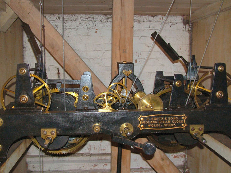
In 1893 at a cost of £120 this impressive clock (made by a steam clock company) was installed.
46 – 83, plus all of Old Priory Gardens, was Liza´s Meadow with Liza´s Barn on the Uggeshall boundary and Liza´s Cottages beside the old A12 trunk road. In one of these thatched cottages lived Eliza Ife who was a female farm labourer, built like a man. Everything in that area was named after her.
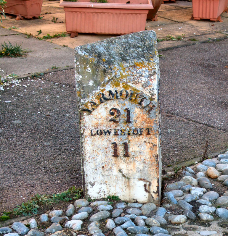
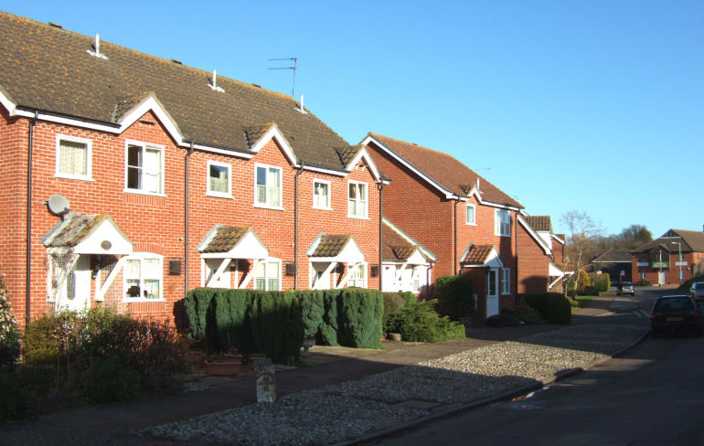
The village milestone was replaced almost in its same spot in front of these modern houses built by local builders from Wrentham, Ellis Homes, in 1983.
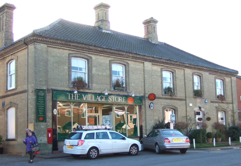
Number 16, the present Post Office, was built by the Henham Estate in 1879 and Listed as the Post Office from then. In 1933 its telephone number was Wangford 7, the highest number in the village. Four years later it was the same, but the District Nurse was Wangford 32. An example of progress at electric speed. A tennis court between the shop and the playing field was used to accommodate the building of a house in recent years.
Now walk to the junction of the High Street and Norfolk Road...
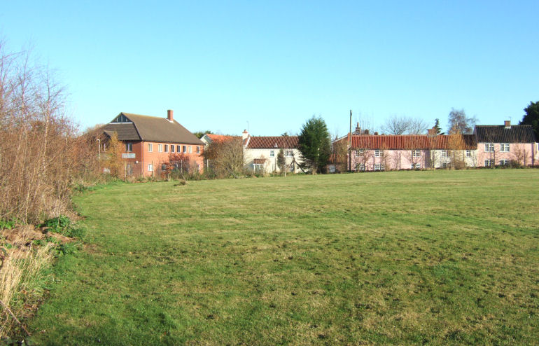
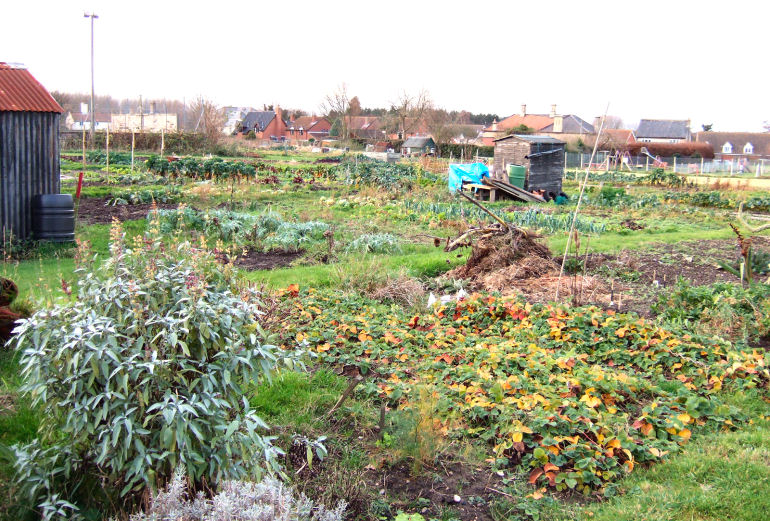
The playing field used to be the allotments, created for the village by Lord Stradbroke from a meadow where cattle once assembled from Elms Farm to either wait near the slaughterhouse or go to the marshes. A cattle pound was probably on the corner of this land, but there is no knowledge of its existence or exact location. The name Pound Corner must date back a considerable time.
The road junction at Pound Corner was originally formed with the main road running straight through Norfolk Road to Uggeshall Road and the old A12 only became the main road afterwards, with the creation of a small green to stagger the crossing for safety. This green was in front of a row of three cottages, which were demolished to build the large office block structure which is now the veterinary clinic.
The blacksmith lived in the house next to the forge, which is now a dog grooming parlour. A market gardener lived in another of the cottages, using the large rear garden, which is now filled by housing.
At the rear of the forge were the wheelwright and undertaker´s workshops, all demolished for housing.
Mill House is the next place on the south side of the old A12 and after the old Post Mill was dismantled, the adjacent gravel pit was used for a time. These were run by Elms Farm. The village policeman lived here briefly in the early 1930s while waiting for completion of the police station opposite.
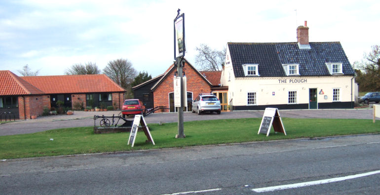
Proceeding to Barnaby Green, the Plough Garage was a large roadside workshop originally run by George Cains before the fire. There were no petrol pumps at this time. The garage burnt down in the early 1930s and was rebuilt by Fred Utting, then Landlord at the Plough Inn. It was used as a bicycle repairer´s before returning to a petrol station in about 1936. The owner´s father, who had a wooden leg, worked as a shoe repairer at the front entrance. The present service station is built on the same site.
The road to the right of the Plough Inn led to a skinning and tanning factory, just around the corner, and this has now been converted to a residential dwelling, known as Blyth Valley Boarding Kennels and Cattery.
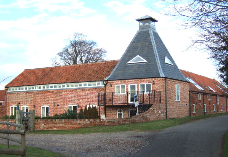
The road opposite the Plough Inn leads back to the village, via Elms Farm Road. On the 9th October 1944, at half past midnight, a German V 1 Flying Bomb exploded after landing in the stockyard (further along the lane) almost opposite the farm cottages, causing much damage and fire to straw stacks. The old barn adjacent to the stack yard has recently been converted to residential use. Further along, the Old Maltings buildings [shown] have retained much of their appearance and character, during conversion to residential use.
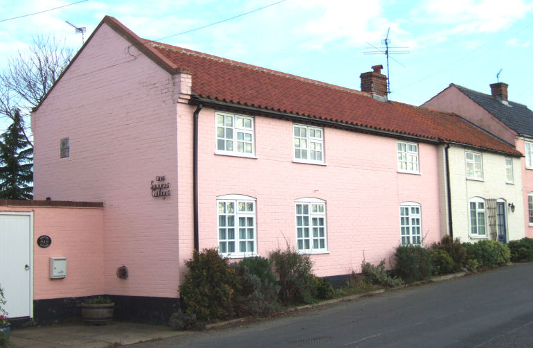
Back at Pound Corner, the beginning of Norfolk Road to the left sees a row of old cottages restored. At the end is Sawyers Cottage, which was the Sawyers Arms Inn, so named because much of its custom was from the men who worked at the saw mill yard that was situated where Church Close is now. It was nicknamed the Barking Dicky, because one of the landlords kept a donkey, which brayed continuously.
Adjoining the pub was a tiny Baptist Chapel built in 1831, which became disused before the end of the century and was then used as a store by the Post Office shop. Some of the walls were left standing when it was pulled down.
The allotments on the west side of Norfolk Road extended from here across to where the tower mill stood, close to the Alms Houses. The mill burnt down on the 7th August 1928 and the adjoining miller´s cottage fell into ruins beside the footpath that crossed from Norfolk Road to Church Street. The mill stood roughly where 19 Millfields is now.
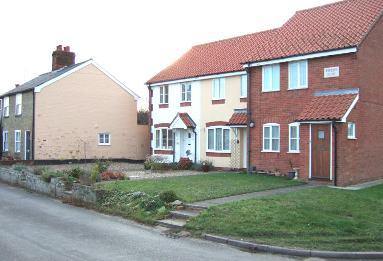
At the Norfolk Road end of the path was an L shaped row of houses, opposite the existing old oak tree, with a communal yard and well. This was encompassed on another side by a row of ancient brick sheds that were originally associated with a tenement block. This was demolished long before living memory. The area was behind the present houses 6 to 12 Norfolk Road. Next to these houses beside Norfolk Road was a well supported Primitive Methodist Chapel with its own burial ground. The grave stones were removed to the church yard when the chapel was demolished to build Piper´s Row [shown]. The origin of that name is something of a mystery to most, except the builder.
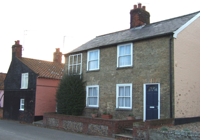
Past the former Chapel Cottages, which is now number 18 [centre], is Pig Yard. This is unchanged except for reconstruction of a house at the bottom end, where the well and pump were. The origin of the name has not been determined.
Next was Black House, having only a three foot strip of surrounding land plus a front yard that was the rear entrance to the next tiny cottage.
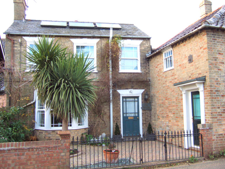
42 is the former Loyal Oak Inn. The accompanying land was on the opposite side of the road and consisted of a semi–circular roadside pull–in and half an acre of garden behind, both now taken for housing.
Jessamine Cottage. A large house, with much garden and orchard extending behind about eight other houses further up the road. Occupied by successive doctors with a surgery, firstly in a small attached annexe beside the house and then in an outbuilding in the yard. John Bickers, the owner of the saw mill business which was located on land at the rear, lived here from the mid 19th Century. A plot of land directly opposite on the other side of the road has always protected a private outlook. Four houses are now in the course of construction on this land.
Next to number 46 stood a meeting hall that used to be used by the Ancient Order of Foresters (Who?).
The last property, at the junction with Church Street, was a tiny sweet shop and the present garage is a downsized former brick barn, constructed in the style known as "brick-on-edge".
At the crossroads (far left) are Southwold Road, Hill Road, and Church Street. There has been some recent controversy over the road name to Reydon. It was recently named Wangford Road, without any knowledge of the villagers. The Parish Council challenged this name with the District Council and was eventually given the choice of name. After some discussion Councillors decided to call the road Wangford Hill.
Hill Road was originally Duck Lane, thought to be a derivation of Dock Lane as boats were once able to reach a quayside here. A few old cottages are in this area and the row of council houses further on, in front of Hill Farm buildings, is the site of Wangford Common. This has been obliterated by the present situation. Around 1860, the name of the farm was Common Farm. Old photographs clearly show the Green.
Some Favourite Websites For November 2025:
Rookyard Cottage, Holton – Eco-friendly self-catering cottage near Halesworth with private heated indoor swimming pool available
Set in over two acres Valley Farm offers two self-catering cottages, Rookyard Cottage and Swallow Barn, both with eco-friendly features and each sleeping up to four people + cot. Rated AA 4 Stars. WiFi. Private heated indoor swimming pool available. Ten miles from seaside at Southwold. Pets not accepted.
Lighthouse View – Superb Southwold self-catering cottage for four
Lighthouse View in Southwold is a comfortable and welcoming holiday cottage sleeping four in two bedrooms. This early-Victorian cottage is in the very heart of this attractive coastal town and the front door it is just yards from the promenade and sea.
Chris Doyle Photography – Beautiful Photos of local nature and recent horse riding events
View extensive online galleries of recent horse shows, show jumping, cross country and other events as well as galleries of local wildlife. Prints are available to order online.
Rosedale Funeral Home – Providing the very best of bereavement care
A family owned local Funeral Home, offering a professional, competitively priced, 24 hour service. Experienced in all aspects of bereavement, whether it is discussing wishes in advance, arranging a funeral at the time of need or providing the very best bereavement support.